Unit 2. Spain: COASTAL LANDFORMS
22Jul
The text will be next Monday 8th November 2021.
There will be a map to locate the gulfs and capes, and activity to write the definitions and to identify the coastal landforms and a map to locate each island in the archipelagos(Canary Islands and Balearic Islands)
COASTAL LANDFORMS IN SPAIN
- Cliff: a high area of rock next to the sea.
- Cape: a piece of land that sticks out into the water.
- Port: place where boats are parked.
- Beach: an area of flat land with sand next to the sea.
- Gulf: a large body of water that enters into the land.
- Bay: is a small gulf.
- Island: piece of land surrounded by water in all sides.
- Archipelago: is a group of islands.
- Peninsula: piece of land surrounded by water on all sides except one.
Cabos
- Cabo Finisterre
- Cabo Ortegal
- Cabo de Peñas
- Cabo de Ajo
- Cabo Matxitxaco
- Cabo de Creus
- Cabo de Palos
- Cabo de Gata
Golfos
- Golfo de Vizcaya
- Golfo de Rosas
- Golfo de Valencia
- Golfo de Almería
- Golfo de Cádiz
Estrechos
- Estrecho de Gibraltar
- Punta Tarifa
Océanos y mares
- Mar Cantábrico
- Mar Mediterráneo
- Océano Atlántico
https://es.educaplay.com/recursos-educativos/820561-cabos_y_golfos_de_espana.html
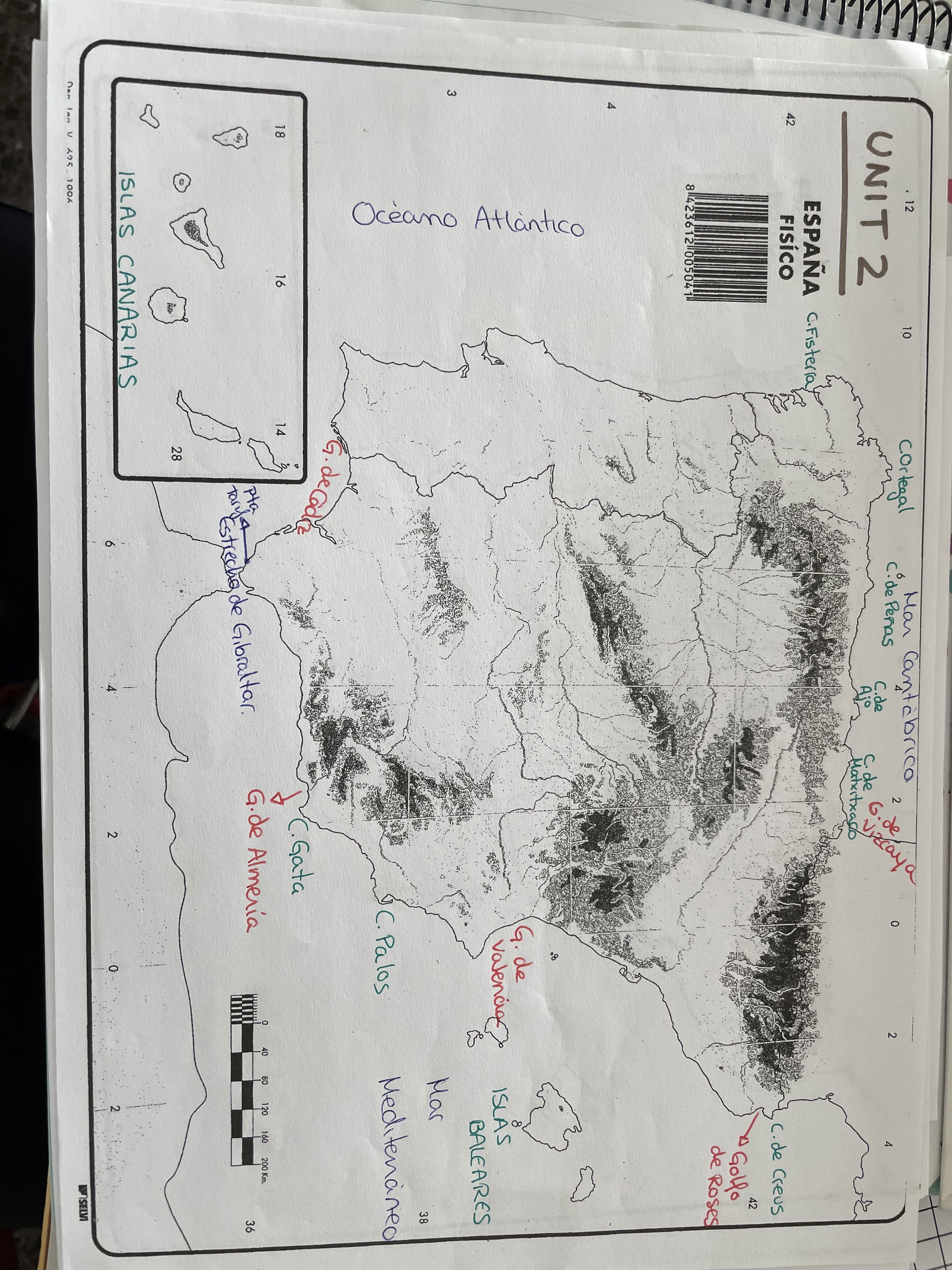
Canary Islands are located in the Atlantic Ocena. They are seven:
- Tenerife
- La Palma
- La Gomera
- El Hierro
- Gran Canaria
- Fuerteventura
- Lanzarote
Balearic Islands are located in the Mediterranean sea. They are four:
- Mallorca
- Menorca
- Ibiza
- Formentera
Comments
